Arbury Park
Arbury Park is a new housing development built across the
border at
the edge of Cambridge. They are being built on an area of what was
disused land far too close to the A14 for anyone to want to live there
and despite most of the houses being on the wrong side of the boundary
of Cambridge City they are being marketed as being in
Cambridge. Despite the name even that small part of Arbury
Park isn't actually in Arbury. It's actually in Kings Hedges.
This is a high profit development. The majority of the houses
being
built are small terraced houses ("town houses") with very small
gardens, in part due to government guidelines that 30-50 homes should
be built on each hectare. They are
packed in tightly and provided with inadequate storage, parking spaces
etc. The
power of marketing helps them to sell quickly despite rather optimistic
pricing in comparison with larger established housing near by and the
A14 being widened in the near future - not something that the marketing
department will be telling anyone about.
Cambridge could do so much better than this. In fact, on one
location in the city back in the 1970s they did do much better. Take a
look at Kings Hedges,
just the other side of Kings Hedges Road from Arbury Park to see a housing estate designed for people.
Or, if you don't want to live on an estate you can
buy non-estate
houses with bigger garden and rather more spread out nearby for similar
sums.
Or, reflect on what Arbury Park is to become:

This photo was taken at "The
Quills" in nearby Girton to show
what
a mess of cars,
wheelie bins and bikes they have there. The houses have not all been
started yet, let alone finished, but sadly, some people who've bought
there are already selling their homes.
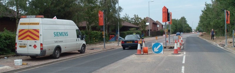
Arbury Park road works
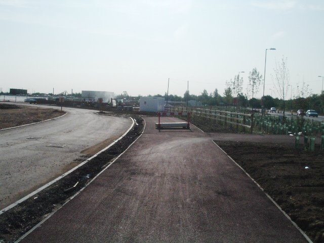
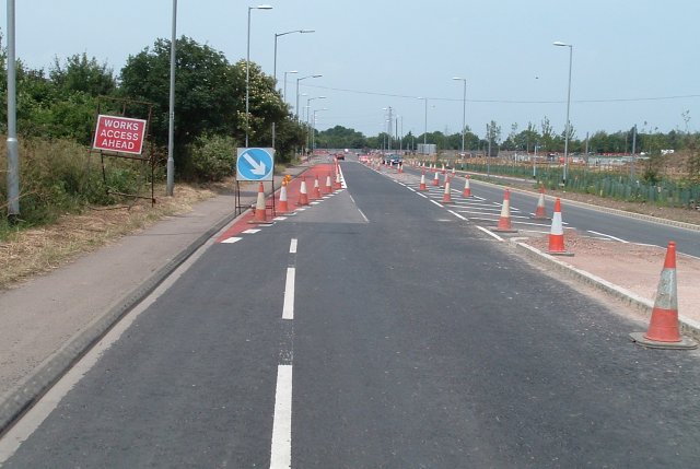
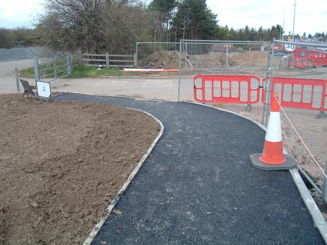
Some aspects of the development at Arbury Park initially appear
to be positive. For instance, the 3 m wide paths, which are the same
width as recommended as a minimum by London's design guidelines for
such shared use paths are much wider than
many of those we have elsewhere in Cambridge.
However, the overall effect of this
development is very negative for cyclists. Some cyclists are known to
have given
up riding on this road, and levels of cycling overall in this area
appear to be dropping as a result of the cycle hostile way in which
development is being carried on.
Update 12th August 2006
I've made a point of crossing Cambridge Road using the new crossings
twice in the last few days and timing how long it takes. This is a
crossing from B to A on the sketched version of the crossing:
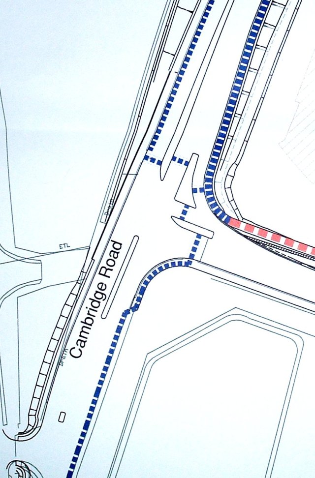
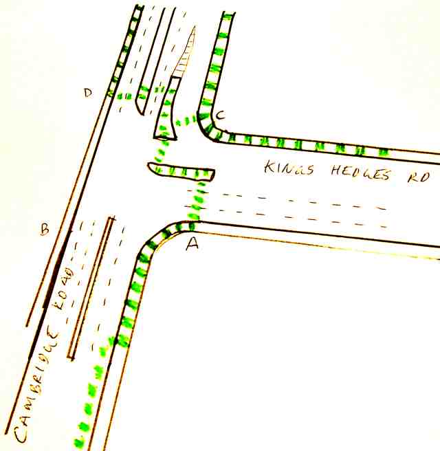
It took me 2 minutes and 37 seconds the first time and 2 minutes and 42
seconds a few days later. The first crossing (from D) took
more
than 1 minute to turn green. The remainder of the time was taken
walking between crossings and waiting for the other three lights to
change colour. Quite a few crossings in Cambridge regularly take over a
minute to allow pedestrians and cyclists across the road, but this one
is now the champion so far as delaying non drivers is
concerned.
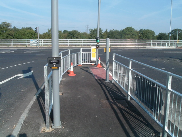
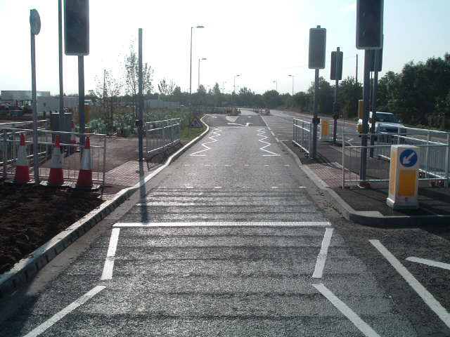
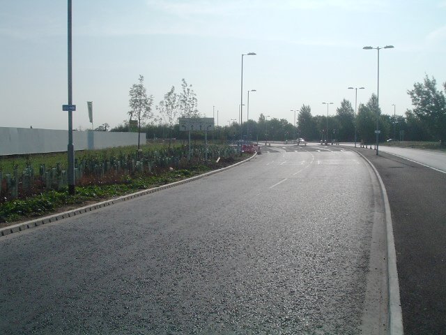
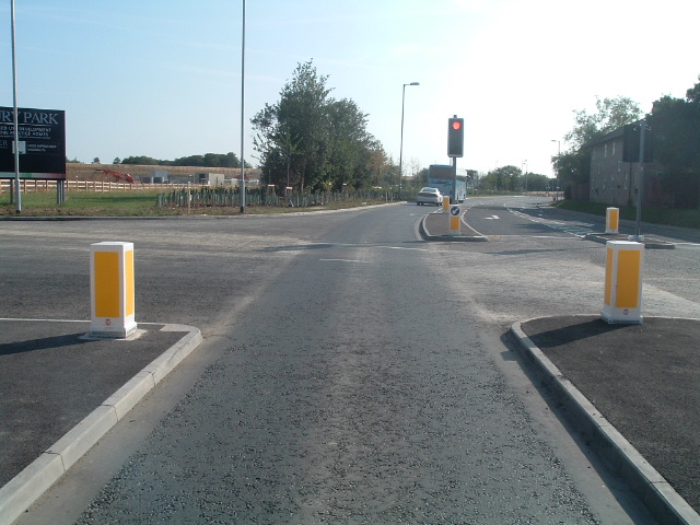
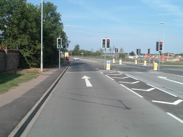
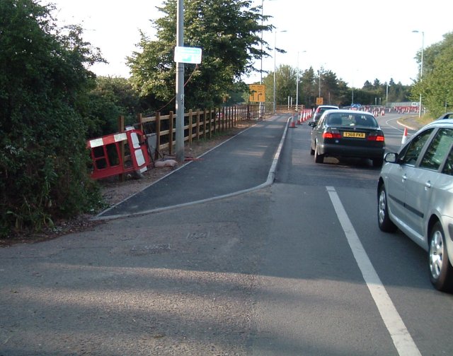
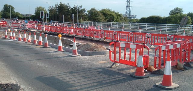
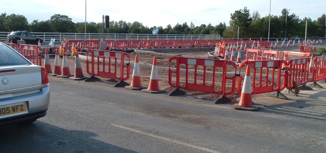
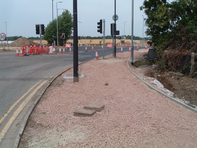
Photos taken 5th August 2006
The road works are now virtually complete, and the road has its final
form. I went out early in the morning to see what conditions are now
like when the road isn't busy.
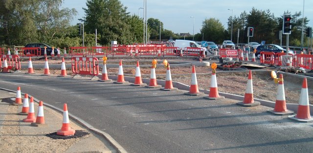
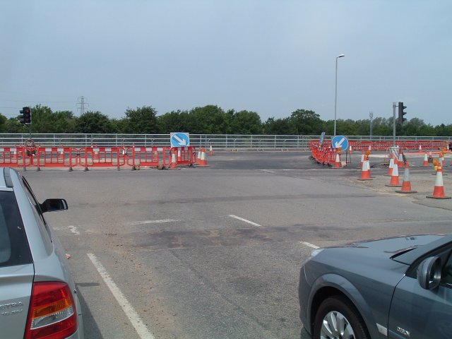
Despite some suggestions that there would be a more straightforward
crossing of Cambridge Road than using 4 separate crossings, all four
are required. Even though the individual delays were not too long (at 8
on a Saturday morning with little traffic) and the lights do try to go
green in a synchronous fashion, it still took a minimum of 40 seconds
for me to cross the road and maximum of over a minute depending on
light phases. For a single crossing (which this should be), these would
be long times. I suspect that at busy times of the day these delays get
longer. One of the islands has been reduced in size a little, but it is
still not terribly convenient.
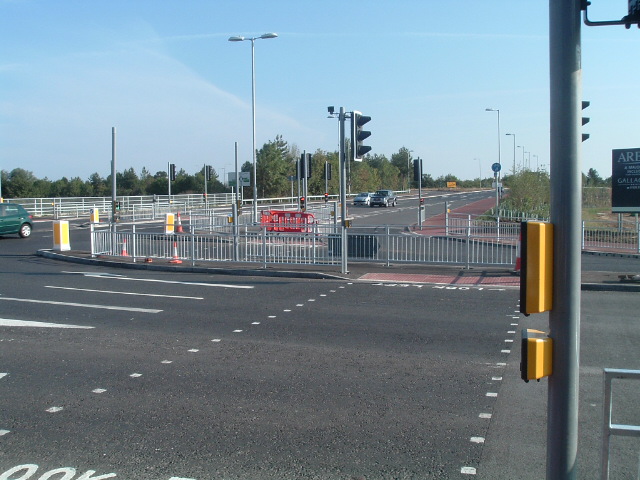
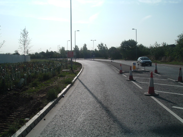
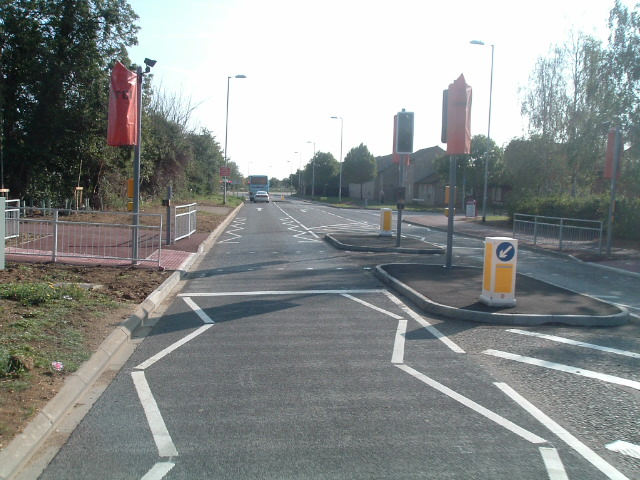
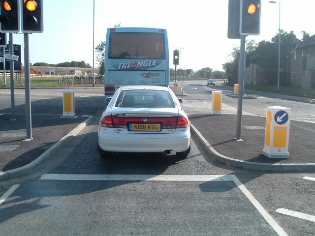
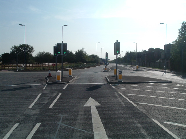
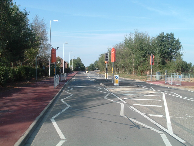
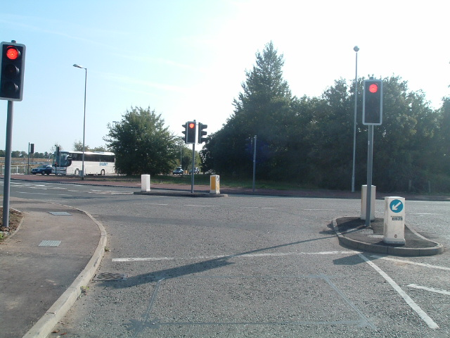
A maze of crossings. The view from the southern side of the Kings
Hedges Road / Cambridge Road junction.
The islands don't provide a lot of room for cyclists and pedestrians
heading in both directions to be able to pass one another.

A nice shiny new Cyclists
Dismount sign has appeared at the Histon Roundabout.
Dangers of heading from West to East along Kings Hedges Road
I decided to try riding from Histon to the Science Park using the path
as far as exists and then going onto the road. The distance along the
road is about 1 mile in length. The path only takes one roughly as far
as the St. Catherine's Square junction of Kings Hedges Road where there
is this awkward double right turn onto a 2 stage crossing:
It looks as if the idea is that cyclists should use the crossing in
order to ride along St. Catherine's Square, but that involves quite a
detour. So, we'll carry on. Approaching the crossing on the road you
find it looks like this:
1st dangerous narrow gap opposite St. Catherine's Square.
Second dangerous narrow gap, this time combined with a slip road to the
left.
Third dangerous narrow gap.
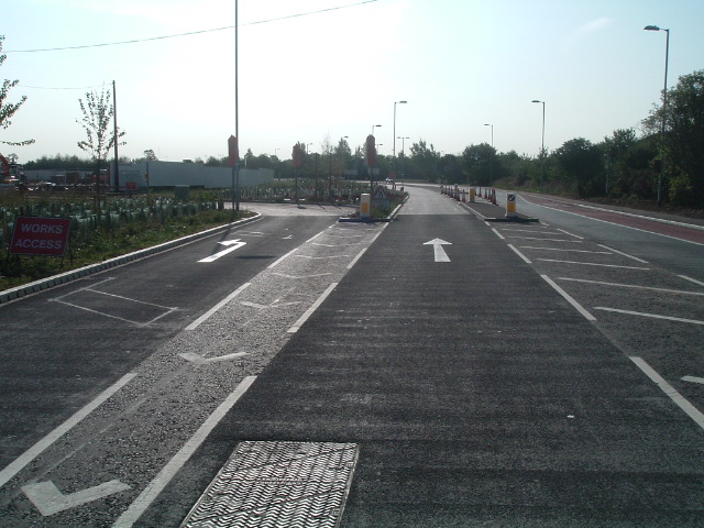
Fourth danger on the lead up to Arbury Road. Cyclists going straight on must be in either the second or third lane from the left. Those who wish to make a right turn at the next junction must be in the fourth lane at this junction. Note the sign on the post at the left side of the photo showing that this is actually a signed cycle route. It's part of a route to a secondary school.
See it before the widening here.
Fifth danger. Two lanes go into one at this narrow gap the other side
of Arbury Road. So, expect drivers to race to be ahead of each other.
Another view showing the way the lanes merge together, with little room
for cyclists when two cars are trying to occupy the same lane.
Sixth danger. Another island in the middle of the road.
Seventh danger. Another narrow gap just short of Buchan Street.
Eighth danger, another narrow gap just the other side of Buchan Street.
Ninth danger. This requires cyclists to pass a long slip road while
looking out for vehicles trying also to negotiate the narrow
gap
with the bus in it.
Another view showing how narrow this is. A car can't safely pass a
cyclist here, but it's wide enough that they might do so anyway.
Tenth danger the other side of the same junction. Another island.
11th danger. Where there aren't islands there is paint. Drivers could
give more room here, but most won't cross the white lines.
12th danger. Another slip road combined with narrow gap.
13th danger. At the other side of this junction is another island which
will keep cars trying to pass bikes close to those bikes.
14th danger. Another island.
Having seen so many narrow gaps within a mile, you may like to read a
very good article about the dangers
of pinch points.
It's much the same story in the opposite direction:
See also the Kings
Hedges Road for Cyclists group. There are now videos showing
how close cars come due to those pinchpoints.
Cyclists who might have been tempted by the St. Catherine's Square
option would find themselves here. There is no way onto the shared use
path opposite from this point.
Photos taken 27th June 2006
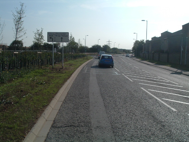
Heading from South to North on Cambridge Road...
This is the point where the old inadequate one way 1.1 m wide cycle
lane ends and the new even more inadequate 1.5 m two way shared use
path starts.
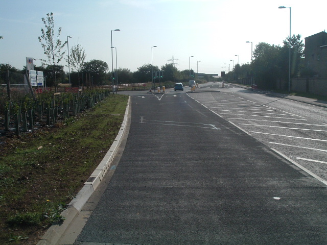
The short cut to the other path is blocked off, as was predicted
before. Note how the narrow path is placed absolutely as close to the
road as it could be, when there is room to the left of it and there
could have been a gap.
This is where the path takes a sharp 90 degree bend and gives way to...
virtually nothing. This is just a stupid way of designing such a
junction. Better practice can be seen elsewhere, such as here
in the Netherlands where a path already somewhat distant from the road
smoothly moves further away so that a straight crossing can be made.
These barriers run alongside the path from here to the roundabout. The
taller barriers part way along are opposite the junction of Cambridge
Road with King's Hedges Road. The barriers ensure that any
cars
which leave the road will run along the path causing the maximum
possible number of injuries to cyclists and pedestrians on the path.
The sensible thing to have done with the barriers would be to follow
the practice used in the Netherlands of putting the barriers between the
road and path.
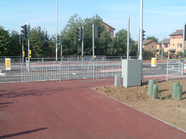
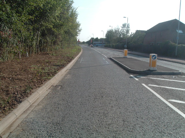
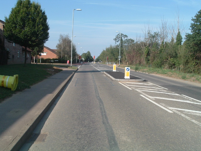
View of one of the new central reservations. Three crossings have to be
used to get across this road. The dropped kerb on the extreme left of
the photo is the position of the first crossing. The second runs from
the dropped kerb roughly central in the photo to the second island
which is under construction further to the right. Then the third
crossing allows our intrepid pedestrians and cyclists to finally get to
the other side of the road.
Of course, they may decide to drive instead, in which case there is
just one traffic light to wait for and no smelly islands in the middle
of the road to stand on.
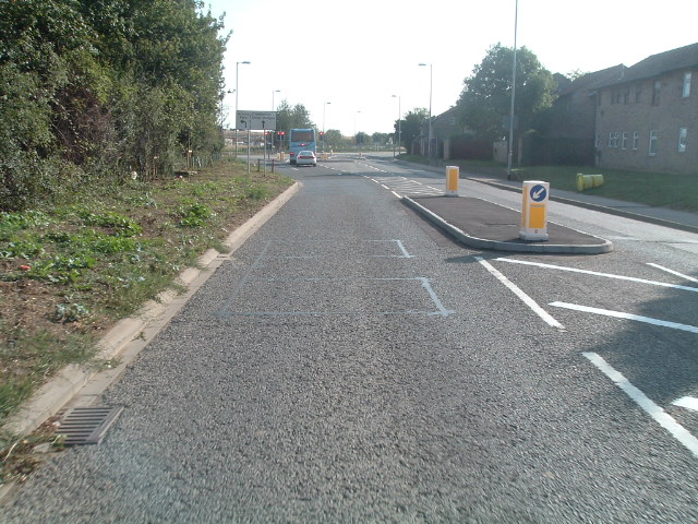
The dropped kerb at the right in this shot is the same one as in the
left on the shot above. This shows the way of crossing to continue
walking or cycling on Cambridge Road into Cambridge. Again, you have to
cross to the near island, then a second island, then eventually you get
to cross to the other side of the road. Again if you are on the road
you have just one light to wait for.
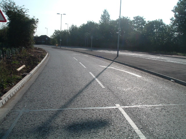
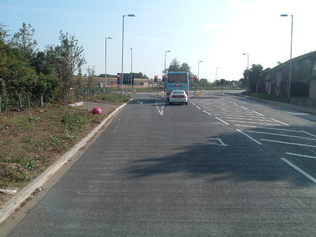
View in the opposite direction. These islands are large.
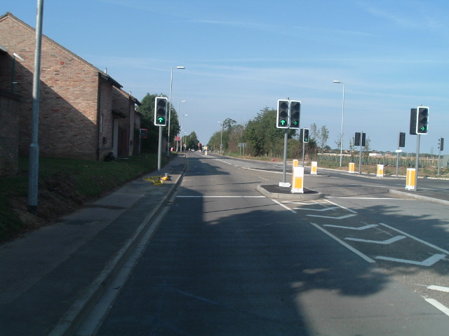
Photos taken 18th June 2006
I rode from Arbury Road to the Histon Junction and back, looking at the
works as I went:
This is the new path on the east side of Arbury Road looking south.
Note that it gets only as far as the entrance to St Laurence's School.
Then there is a right angle bend for cyclists, even though there is
nowhere for them to go if they cross the road, and a narrow footpath
which isn't accessible in a convenient way due to the crossing
controller box being in the way.
Surely it would have been best to have moved the controller. Otherwise,
why not take the path behind the controller ? This shared use path
really shouldn't stop at this point because at the other end of the
front of St. Laurence's a path starts which could take
cyclists all the way to the shops at Arbury Court or to Kings Hedges
Primary School.
This shows Kings Hedges Road at the top, Arbury Road running top left
to bottom right, the Meadows estate to the left of Arbury Road at the
top, St. Laurence's School to the right of Arbury Road, St. Albans Road
half way down on the left.
I modified this part of the plan to show existing shared use paths in
green and ones which are required to make them link up with the new
development's paths in red. You can see that the developers are putting
in some of the required links, but not all. Without the paths providing
a continuous and pleasant path to some place, it is difficult to see
what they are for. The new development will largely be cut off from the
rest of the city by the newly redesigned King's Hedges Road, as none of
the proposed cycle or pedestrian exits require fewer than three toucan
crossings to be used to cross the road, and there will not be enough of
these crossings, particularly to the eastern end of the site.
They are also not building
all of the paths originally shown on the plan in blue. The path running
left to right at the top left corner of the plan is not being built
until the guided bus is built.
Looking in the opposite direction, north along Arbury Road we see this
forest of posts. There is no dropped kerb to allow cyclists on the path
to access the Meadows estate, to the left from this photo. There also
isn't anywhere for cyclists on the road to be able to join this path
should they want to. Also note the metalwork in the path. It appears
that a decision has been taken to put all the metalwork in the shared
use path rather than on the road. This is dangerous because such
metalwork, especially when wet, presents a much greater danger to those
on two wheels than those on four. This is heightened when radii are
smaller as they are on a path like this which takes the inside of the
bend. Note that there is very little room for tarmac on top of the
loose mixture. This surface may start off flat, but it soon will no
longer be flat.
Given that this path doesn't allow access to or from the road, it need
not have been built so close to it. To the right on this photo,
especially a few metres further on, there is a considerable
area of unused land which would have been pleasant for cyclists who
could be further from the traffic for a while.
View in the opposite direction from the Arbury Road / Kings Hedges Road
junction. Note the number of pieces of metalwork in the path. Whatever
line you take around this corner you will inevitably run over at least
one of these, which may well be slippery in the wet.

This is shot from the Arbury Road / Kings Hedges Road junction looking
west. One piece of reasonably good news. The cycle lane is taking up a
part of the very wide lane here. However, this isn't really good
enough. Why not a mandatory cycle lane ? Given the enormous width, why
not a cycle lane wider than the minimum of 1.5 m ? Also, it doesn't go
very far...
After a few metres, the cycle lane merges into a bus lane. This shows
how wide the cycle lane could have been for its entire length. For a
bus lane shared with cyclists this is none too wide. Buses and taxis
will have to stay behind cyclists due to not being able to overtake
safely. Or, quite possibly they will force their way past putting
cyclists into danger.
At the end of Kings Hedges Road, it appears that right turning cyclists
are expected to ride between the blue signs with motorists. Because
this road is now twice as wide and with a larger radius than before,
those motorists are likely to be travelling faster. Due to cyclists
having to go further to the right to avoid the island being built, the
motor vehicles are also likely to pass closer.
All plans I've seen appear to expect cyclists to dismount at this point
and use four toucan crossings to cross the road. This is taken from
August 2004 plans, produced after criticism from the Safety
Audit of January 2004, but apparently not taking that criticism into
account.
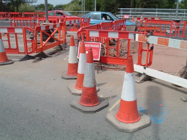
If you turn left at the end of Kings Hedges Road in order to use the
temporary crossing you find yourself heading for this nasty tight gap
between cones.
And then this damaged ramp. Don't try to ride on the left half of it,
as you'll
surely come off your bike.
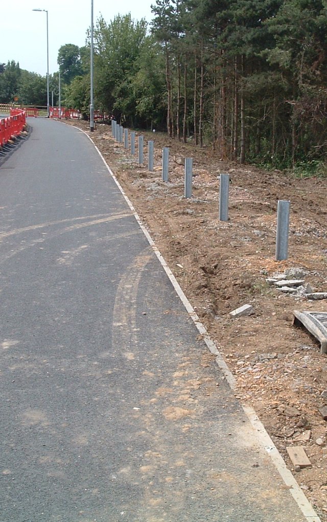
Look to the left, south along the west side of Cambridge Road and you
see this. Note the Z cross section posts which will hold a safety
barrier designed to stop motorists who leave the road from finding
themselves in the ditch. This was criticised by the safety audit of
January 2004 because putting the barrier on this side of the path means
that motorists will instead of landing in the ditch be diverted along
the path wiping out pedestrians and cyclists as they go.
This is not a minor issue. 200 pedestrians a year are killed on the
pavement by drivers who have left the road. This compares with 0 per
year killed on average by cyclists.
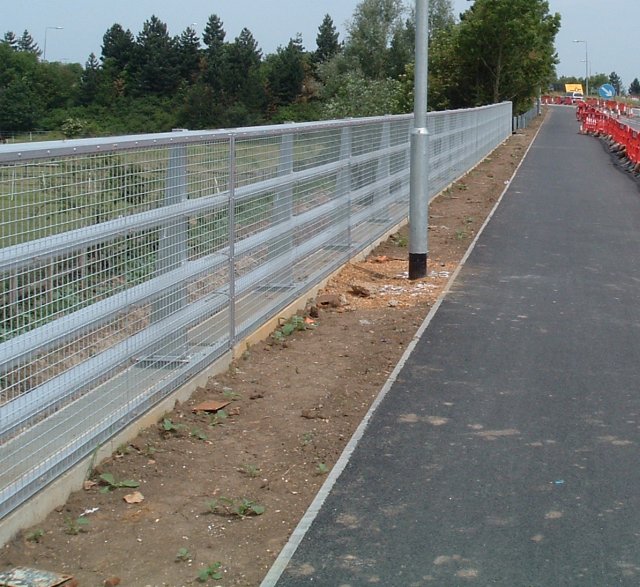
Much the same to the North, more "safety" barriers which put
pedestrians and cyclists in more danger.
A little further north, more barriers. In this shot at the top right
you can also see the barriers which cause the same danger on the other
side of the road.
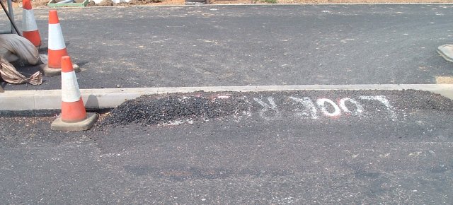
A temporary narrowing, but typical disregard for what pedestrians and
cyclists actually need. It's also another opportunity to see just how
thin this path is. It is nice and smooth now, but won't be for long.
For a little while it seemed like someone had seen sense and decided to
put at least one of the traffic light posts to the side of the path and
cantilever over the path to the correct position. However, someone
else clearly decided that as this wasn't to the same standard of path
obstruction as the rest of the works, it'd better be replaced. So, the
traffic lights moved from one post to the other in the last few days.
Photo taken 12th June 2006
Yet again life has been made more dangerous for cyclists on the path or
on the road along Kings Hedges Road. These obstructions are on a new
path on the southern side of the road only between Buchan Street and
Arbury Road.
Photo taken 8th May 2006
The islands cause cyclists on the road to be in danger due to cars
passing too closely. This was criticised in the safety audit of the
plans for this development carried out in January 2004. Also, the posts
in the path narrow the already dangerous 1.5 m bidirectional shared use
path, and are also too low, causing extra danger for anyone cycling on
the path.
Photos taken 17th April 2006
These show the start of a bit of path on the west side of Cambridge
Road south of the Kings Hedges Road junction. This path is just 1.5 m
wide, which is hopelessly inadequate for a bidirectional shared use
path. London's guidelines say that such a path should be 3 m wide as a
minimum.
Note how this does not include the cut through to the left here to meet
up with the well used NIAB track:
Also, carry on a little while and you find yourself at a dropped kerb
at a peculiar angle trying to cross a side road. The on road cycle lane
which used to exist (albeit a totally inadequate 1.1 m one) didn't
require cyclists to give way to the side road. The path the other side
of this junction is 3 m wide:
Google Maps image showing the old mandatory cycle lane (with parked
car) and the cut through which is being lost marked by a yellow arrow.
The detour for cyclists and pedestrians wanting to use the NIAB path is
to go north to the junction and back again.
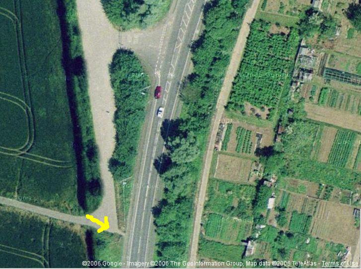
The image is also available here. You can scroll around and see other
parts of the site before development: http://tinyurl.com/q652j
Photo taken 11th March 2006
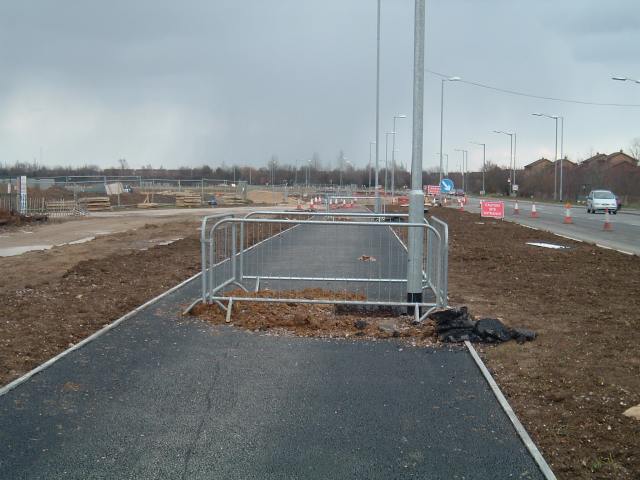
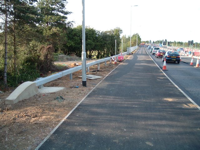
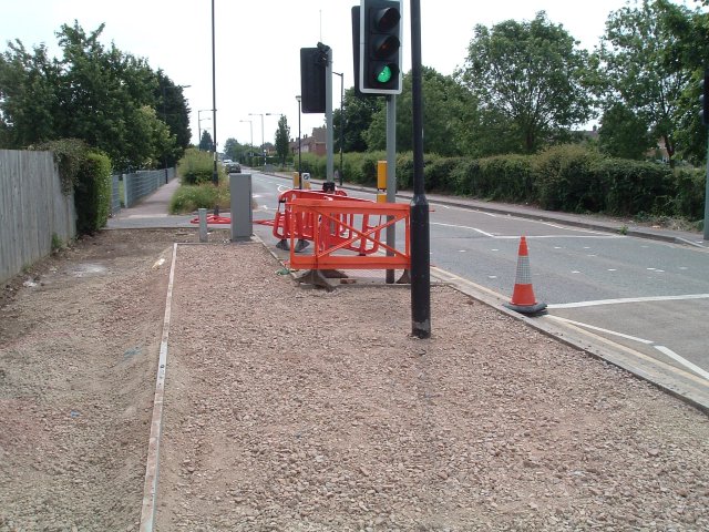
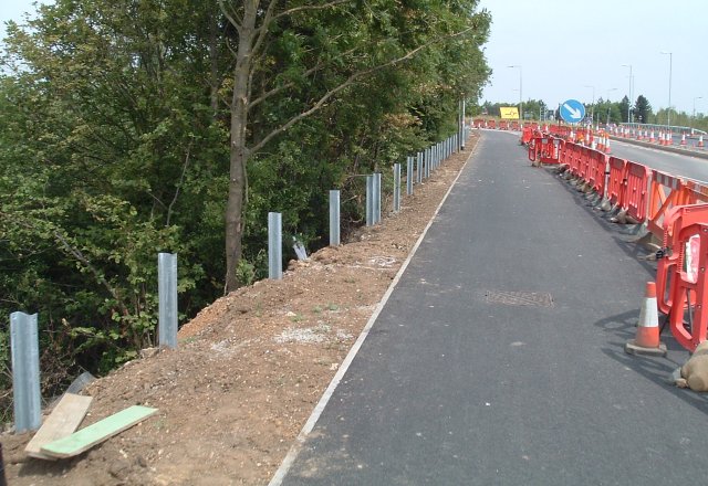
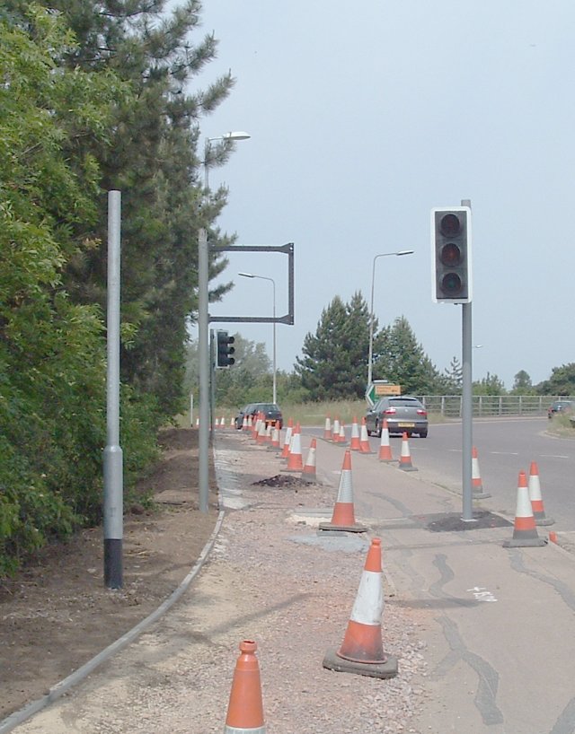
Despite there being masses of room to put the lamp posts on either side
of the shared use path, they are instead being put on the path itself.
This is
a view east along Kings Hedges Road from the Cambridge Road / Kings
Hedges Road junction.
More information
Cambridge Cycling Campaign newsletter has included articles about the
problems caused by the development:
First
article
Letter
in reply from South Cambs District Council
Second
Article
Third
Article
For more pictures, see Des Philips
excellent web page.
See also the Kings
Hedges Road for Cyclists group. There are now videos showing
how close cars come due to those pinchpoints.
Also, I have a number of earlier
photos of the works being built and some highlights of other duff cycling provision in Cambridge.
Read The Truth about Cambridge which I wrote after four years living in the Netherlands and reflecting on how Cambridge had not changed at all when we visited the city.
My main
web site.
Dutch Bike Bits - a shop specialising in tried and tested bicycle parts.
We organize cycling infrastructure study tours for people who have an interest in how the Netherlands achieved its world leading level of cycling.